Randonnée 15326 La Tête de jacquette - Provence-Alpes-Cote-D'Azur, Hautes-Alpes (05)
Rando proposée par: Playmobil88
Cette page a été affichée 2112 fois.

Type
Boucle

Distance
11.5 Km

Altitude maxi
2560 M

Altitude mini
1790 M

Durée
6h

Difficulté
difficile


Balisage
Oui

Accès
Ceillac Hautes-Alpes (05)

Départ
Le Villard

Dénivelé
790 M

Référence carte
3537ET Série bleue IGN
| Photos | Type | Titre |
|---|---|---|
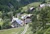 |
Gîte | Aux Moulins |
 |
Gîte | La Rua |
 |
Gîte | Les Arolles |
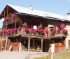
 |
Locations | Le Coin des Aigues |
 |
Camping | Camping Les Mélèzes |
 |
Appartement | Epine Vinette |


Météo
Impossible de charger les données météorologiques.
CLIQUEZ ICI pour enregistrer votre randonnée