Randonnée 16137 Randonnée Docelles - Le Haut Bois - Lorraine, Vosges (88)
Rando proposée par: Chilo
Cette page a été affichée 554 fois.
Randonnée de 15 kl dans le massif du Fossard au-dessus de Docelles. Village au riche passé papetier, baignée par la Vologne.

Type
Boucle

Distance
15 Km

Altitude maxi
680 M

Altitude mini
380 M

Durée
4h

Difficulté
moyenne


Balisage
Oui

Accès
Docelles Vosges (88)

Départ
Place de l'Espine

Dénivelé
450 M

Référence carte
3518OT série bleue IGN
| Photos | Type | Titre |
|---|---|---|
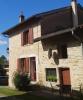 |
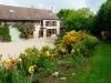
Gîte | Gîte les Argillets |
 |
Gîte | Gîte l'Angelot |
 |
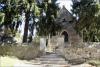
Centre et village vacances | Le Vert Plateau |
 |
Gîte | Gîte du Pôle |
 |
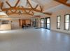
Gîte | Chalets Les Prenards |
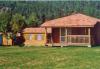 |
Camping | Le Vieux Moulin |
 |
Chambre d'hôtes | Le Bambois |
 |
Hôtel, Auberge | Hôtel Le Seignelay |
 |
Chambre d'hôtes | Les Champs Cordois |
 |
Chambre d'hôtes | Le Val du Chapelain |
| Photos | Nom | Présentation |
|---|---|---|
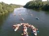 |
Open Kayak |
"A Joigny, en famille ou entre ami à 1h30 de Paris, en Bourgogne-Franche-Comté, Découvrez la beauté des paysages vallonnés et verdoyants de l'Yonne en naviguant paisiblement à bord d'un canoë-kayak, d'un paddle ou d'un pédalo sur nos parcours de 5 à 20 km ." |
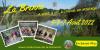 |
La Randonnée de la Brenne |
|